For our mob we see the land as our mother. Our Elders have taught us that we were made from the earth and our mother (the land) provides us with food, clothing and shelter and therefore we must treat her with respect and care for her as we would our family.
We would travel to different areas within our country, depending on the weather and where the hunting would best suit us. We would always be cautious of where we set up camp as we never wanted to go on to someone else’s country without their permission or an invitation.
We would move around every few days, this ensured that we did not deplete our land of its resources as moving around allowed it to flourish again. We would typically travel no more than a few miles in a day.
The Elders would decide where we would camp as they held the deepest knowledge of the land. The women would reach camp first and organise the fire and the water. Often women would travel with a smouldering piece of fungus that would burn for hours; this allowed the fire to be set up quickly.
In the warmer months we all move closer to the Yarra and camp along the banks. Due to the heat our shelter may only consist of a few branches to protect us from the wind.
In the colder months we retreat further into the hills, where we construct comfortable houses called a willam which means ‘home’ or ‘bark’. They were a simple design, similar to tents we use today when we go camping. We would build our willams facing the east or north-east as we knew that the winter winds would blow from the south or south-east.
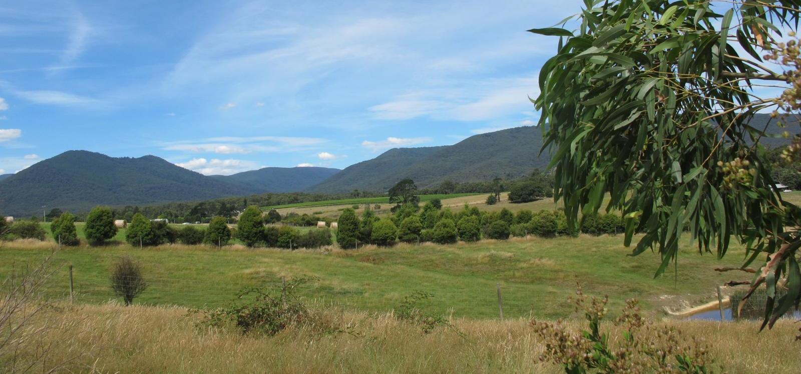
Different foods are available at different times of the year and we follow these patterns with our campsites. During breeding season for example, hundreds of birds will gather at Yarra Glen providing an easy source for meat and eggs. In the autumn eels will migrate to Port Phillip Bay. We will capture these in our traps and weirs to feed hundreds of people for a great festival at certain times of year, places like Kangaroo Ground have an abundance of kangaroos and rich fields of yams and orchids and other bush foods to gather. We would burn off those lands regularly, so the plants will grow back lush and attract animals.


Image Source: Logging our Native Forests destroys the future of our Country, by Georgia Mae Capocchi-Hunter
The Seasons
Before Invasion, Wurundjeri people had a different concept of the seasons. Middle Yarra had 6 seasons called high summer, late summer, early winter, deep winter, pre spring and true spring. Upper Yarra, around Healesville, is said to possibly have 7 seasons.
- High summer occurred from November to January. This is when the weather would grow from warm to hot, native grasslands would grow tall and birds would be feeding their new young.
- Late summer occurred around February to March and was hot and humid with plenty of thunderstorms. Grasslands would dry out sand there was a high fire danger.
- Early winter occurred around March to May. This is when it would cool down and was misty. Birds would migrate north and fungi would begin to grow.
- Deep winter occurred from June to July. This was the oldest time of the year and was very wet with rough seas. Antarctic birds would migrate over our country.
- Pre-Spring occurred from July to August. The weather would begin to warm, flowers would bloom and birds would begin to nest.
- True Spring occurred between August and November. The weather was warm but still wet. There was an abundance of flowers and insects.
Significant areas of interest
Mt William Quarry
One of the most important tools in our communities were stone hatchets – each camp had to have at least one. The hatchets were made from a hard stone shaped and then ground against another stone to make an edge that was able to be used for cutting. Mt William or Wil-im-ee Moor-ring (Woiwurrung for tomahawk place) was a greenstone quarry. Greenstone was one of the best rocks for hatchets and so hatchet heads from Wil-im-ee Moor-ring (Mount William) were highly sought after. It is said that for a single hatchet head the trade was 3 possum skins (when you think about the effort need to get 3 clean possums skins it shows just how valuable these stone heads were.) Wil-im-ee Moor-ring (Mount William) is a large and intensively-worked quarry site in southeast Australia significant also for the extent of exchange across Australia. You can read more about it here.
Coranderrk
Coranderrk Aboriginal Station is located on the Yarra Flats, bordered by the Yarra River, Badger creek, Watts River and the slopes of Mount Riddle. It was established for the Wurundjeri people but was also home to other people from the Kulin Nation. The reserve was named Coranderrk which was the Woiwurrung name for the Christmas Bush – a white flowering summer plant which is native to the area. In 1998, with help from the Indigenous Land Corporation, the descendants of the Coranderrk community were able to buy back a small portion (0.81 km²) of the land that was taken from their ancestors. It was also added to the Australian National Heritage List on 7 June 2011. Coranderrk remains to this day a place of huge significance for Wurundjeri and other Kulin people.
Looking north to Coranderrk near his birthplace of Brushy Creek. ‘You got to know your father's country..Me no leave it, Yarra, my Father's country. There’s no mountains for me on the Murray.’
Image Source: Barak: Coranderrk Country. Culture Victoria
Yarra Ranges National Park
Yarra Ranges National Park is located in the Victorian Central Highlands. The park is home to many majestic Mountain Ash trees, one of the tallest tree species in the world. You can visit the Rainforest Gallery with its spectacular observation platform and rainforest walkway on the southern slopes of Mount Donna Buang. The Park is home to a wide diversity of fauna including kangaroos, wallabies, wombats, platypi and 120 species of native birds.
Birrarung/Birrarung Marr
Birrarung is the Woiwurrung name for the Yarra River and the Birrarung Marr is an inner-city park on the banks of the river that was opened in 2002. Birrarung means “river of mists” and Marr means to the side of the river. From Princes Bridge, the park incorporates three terraces of contrasting grass and sand with a variety of installations and facilities. The Birrarung Wilam installation celebrates the diversity of Victoria's Indigenous culture by interpreting stories through public artworks. A winding pathway acknowledges the significance of the eel as a traditional food source and a semicircle of metal shields represents each of the five groups of the Kulin Nation. Other features of Birrarung Marr include Deborah Halpern's two-headed Angel sculpture and the Federation Bells, ringing out three times daily with different compositions. The park's William Barak pedestrian bridge leads directly to the Melbourne Cricket Ground (MCG)
Healesville Sanctuary
Healesville Sanctuary is internationally renowned for its work saving endangered Australian species at the Australian Wildlife Centre. Visit the centre, which treats more than 2000 sick and injured native animals every year. Wander through the tranquil tracks and meet over 200 species of Australian animals, including the iconic koalas, kangaroos, platypus, dingoes, wombats and emus in their natural surrounds.
Badger creek
Badger Creek is the home of Healesville Sanctuary and backs on to the Coranderrk Bushland. It is said it gets the name from early colonists mistaking our wombats which frequented the area for badgers. There is a great picnic area at the Badger Weir plus a variety of walking tracks with varying difficulty. In the summer you can take a dip in the creek.
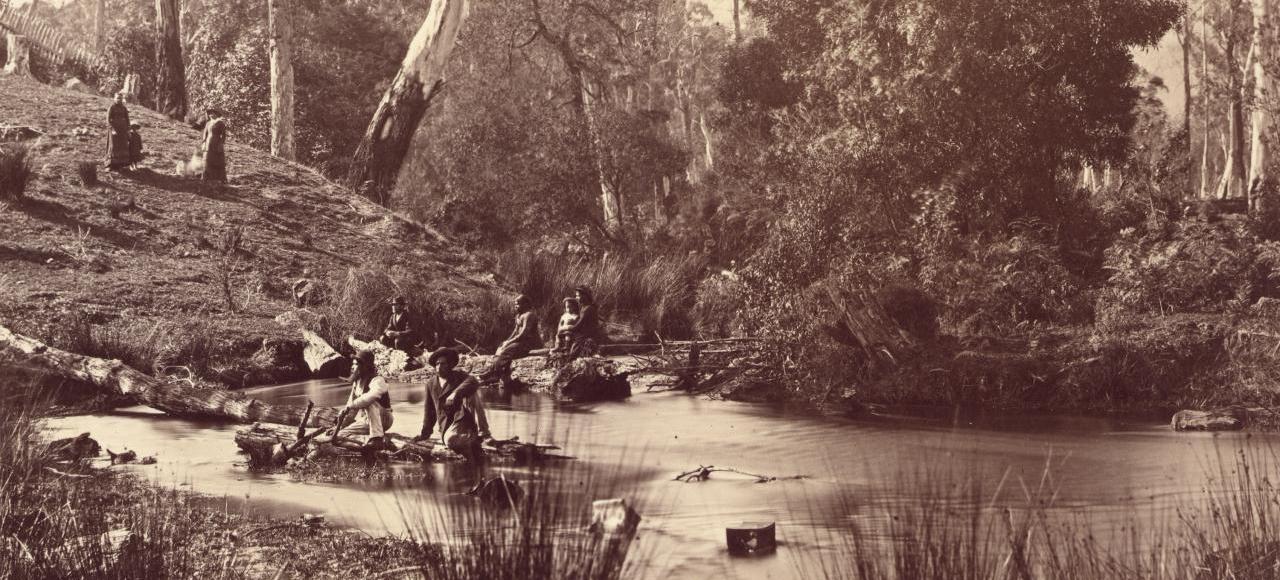
It is said the name 'Badger Creek' is derived from the early colonists mistaking our wombats which frequented the area for badgers.
Image Source: Scene, Badger Creek, Coranderrk (c. 1876) Fred KRUGER. NGV
Panton Hill Reserves
There are seven bushland reserves in the Panton Hill, Smiths Gully and Watsons Creek area collectively known as the Panton Hill Bushland Reserve System. These are owned and managed by the Nillumbik Shire Council. The reserves are significant for their diverse range of native flora and fauna it has many historical and heritage sites, and provides an opportunity for environmental education and recreation. The seven individual reserves are named using Wurundjeri names for species found in the Reserves. These reserves are;
- Bulwidj (Yellow Box)
- Bunjil (Wedge-tailed Eagle)
- Gawa (Echidna)
- Wimbi (Swamp Wallaby)
- Wurran (Sugar Glider)
- Yanggai (Yellow-tailed Black Cockatoo)
- Yirrip (Ironbark)
Gawa Wurundjeri Resource Trail
The Gawa Wurundjeri Aboriginal Resource Trail is part of the Panton Hill Bushland Reserves System. Situated near Watsons creek it is a self-guided tour where you follow markers that explain how the Wurundjeri clan that lived near the creek, and used the land to obtain bush foods, medicines, implements, shelter and clothes - all created by their Dreamtime spirits.
Aboriginal Heritage Walk, Royal Botanic Gardens
The Aboriginal Heritage Walk starts off at the Visitor Centre where you will be greeted by your Aboriginal guide. The experience commences with a traditional smoking ceremony – a custom among Aboriginal Australians to acknowledge ancestors and pay respect to the land, and to ward off bad spirits. Embark on an exploratory walk through important areas of the Gardens as your guide discusses the local First Peoples’ connection to plants and their traditional uses for food, medicine, tools and ceremonies. Finish off your walk with a refreshing cup of lemon myrtle tea while you share stories and reflect on the significance of Aboriginal culture in Australia.
Bolin Bolin Cultural Landscape Trail
This is a trail best to do in summer as it can become really muddy after rain. Make sure you look where you are going as it is easy to get lost and for this reason it is best walked with a friend. The walk takes you through riverine habitat, along narrow dirt paths and into the sacred domain of the Bolin Bolin Billabong. The trail is also home to many Giant River Red Gums. This is a very special place imbued with strong spiritual association for Indigenous people. It is likely you will hear kookaburras and possibly see lizards and turtles. Watch for snakes in summer. There are signs along the path with Indigenous interpretation.
Galeena Beek
Galeena Beek was built at Coranderrk Aboriginal Station and operated as a cultural centre that was open to the public. It was also a place where the Aboriginal community could meet to have important discussions, have cultural celebrations and display artwork.
In the late 1990’s Galeena Beek was closed down and from then on, several businesses have operated out of the site, including an art gallery, wedding reception and restaurant. As these businesses were unsuccessful the property was then officially unoccupied for approximately 10 years, with ownership being retained by the government.
The Wurundjeri council has campaigned for many years and finally in 2018, with the support of local organisations, the Wurundjeri Council was successful in taking back ownership. The Wurundjeri community plan to return the building to its original form as a cultural centre.
Abbotsford Convent
The Wurundjeri Council is located at the Abbotsford Convent in the Providence building. There is a section of the building that houses artefacts and important pieces of our history.